
1. Киришүү
The SMAJAYU R26 V1 is a professional-grade NOAA-certified GNSS IMU RTK GPS land surveying equipment designed for high-precision geospatial data collection. It offers exceptional accuracy and wide compatibility with various protocols and file formats, making it suitable for diverse surveying applications. This manual provides essential information for setting up, operating, and maintaining your R26 V1 system.
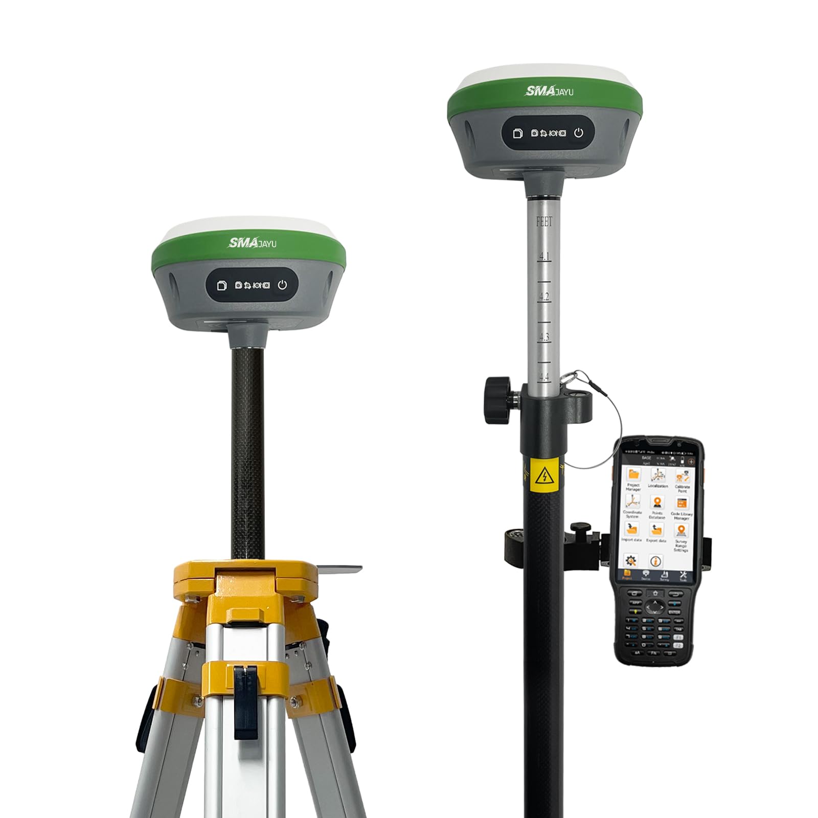
Figure 1: SMAJAYU R26 V1 GNSS IMU RTK GPS Land Surveying Equipment.
2. Кутуда эмне бар
The SMAJAYU R26 V1 package includes the following components:
- GPS rover
- RTK базасы
- Handheld surveying equipment

Figure 2: Contents of the Base and Rover boxes, including GNSS receiver, tape measure, disc, power adapter, cables, extension rod, terminal antenna, handheld collector, charger, software, and handheld bracket.
3. Негизги өзгөчөлүктөрү
- NOAA Certified: The SMA26RTK is officially certified by NOAA, ensuring compatibility with standard post-processing systems for reliable geospatial data collection.
- Exceptional RTK Accuracy: Achieves 3mm–8mm accuracy when surveying with rover + base, based on extensive field testing.
- Wide Protocol Compatibility: Supports Transparent, TT450S, Trimtalk, TRMMARK3, SOUTH, and SATEL radio protocols, ensuring broad compatibility with various base stations and GNSS ecosystems.
- ийкемдүү File Формат колдоо: Supports import of .dat, .txt, .csv, .rw5, .raw, .kml, .kmz, .ncn, .pxy, .crd, .dxf, .shp, .dwg. Exports to .dat, .txt, .csv, .dxf, .dwg, .shp, .kml, .kmz, .gpx, .jpg, .html, .xls, .ncn, .pxy, .crd, .raw (saved in project).

Figure 3: Illustration of GNSS+IMU RTK Technology, highlighting increased measuring point efficiency by 20% and staking efficiency by 30%, with RTK tilt-compensated accuracy of 25mm within 30° tilt angle.
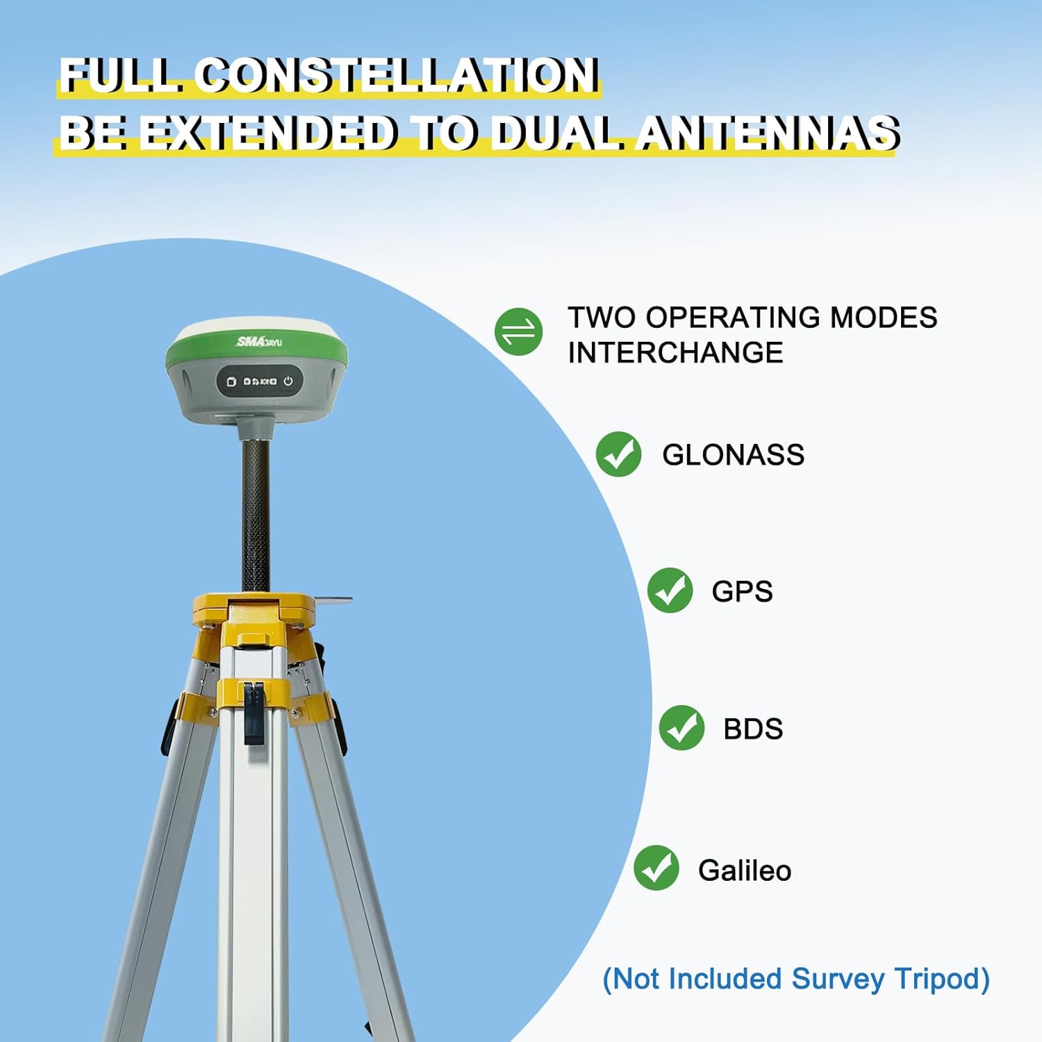
Figure 4: The R26 V1 supports full constellation GNSS, including GLONASS, GPS, BDS, and Galileo, for enhanced positioning accuracy.

Figure 5: The R26 V1 features an all-in-one design with built-in Bluetooth, wireless connectivity, storage, positioning, advanced antenna, and inertial navigation.
4. Орнотуу
Follow these steps to set up your SMAJAYU R26 V1 for surveying operations:
- Connect Collector to Base: Connect the handheld collector to one R26 unit via Bluetooth to configure it as the base station. Navigate to 'Communication' in the app, select Bluetooth, and connect to the device. Then, set up the base parameters including cut-off angle, input base coordinates, data link settings (channel, frequency, protocol), and click 'Set Base Startup'.

Figure 6: Step 1 - Connecting the collector to the R26 base.
- Инициализацияны күтүңүз: After setting up the base, wait for approximately 3 minutes for the system to initialize and stabilize.

Figure 7: Step 2 & 3 - Waiting and connecting to the rover.
- Connect Collector to Rover: Stop the connection with the base and connect the collector to the second R26 unit, configuring it as the rover. Ensure the same radio protocol and channel are set on both the rover and base until a 'FIXED' status is displayed.

Figure 8: Step 4 - Setting up the R26 as a rover.
- Start Surveying: Once the rover is configured and shows a 'FIXED' status, you can begin parameter setting and your surveying job.

Figure 9: Step 5 - Starting surveying operations.
Маанилүү кеңештер:
- Сигналдын абалы:
- БИР: Not connected to the base station.
- FLOAT: Connected to the base station, but the number of satellites is small. Accuracy may be insufficient; move to a location with better signal for a fixed solution.
- ОҢДАЛГАН: Connected to the base station, and the signal is normal. Ready for surveying and mapping work.
- Иш чөйрөсү: The base station should be set up in an open and unobstructed area. The rover should avoid working in blocked areas. When testing, it is recommended to keep at least 3 meters away from obstacles.

Figure 10: Signal status indicators and environmental tips.
5. Иштөө нускамалары
The R26 V1 handheld collector features intuitive controls and a clear display for efficient operation. Understanding the device's buttons and workflow is crucial for accurate surveying.
5.1 Түзмөктү башкаруу элементтери

Figure 11: Device buttons and indicator lights. Includes Recorder light, Differential light, Still recording button, Power button, Satellite light, and Power light descriptions.
5.2 Survey Workflow
The general survey workflow involves device setup, surveying, and data sharing:
- Түзмөктү орнотуу: Connect the base and rover units as described in the Setup section.
- Сурамжылоо: Utilize various survey functions such as Point Survey, Detail Survey, Control Point Survey, Point Stakeout, CAD, Line Stakeout, DSM Stakeout, Stake Road, and Electric Lines Survey.
- Маалымат бөлүшүү: Share coordinate parameters, points data, and data files.

Figure 12: ашыкview of the survey steps and available functions.
6. Маалыматтарды башкаруу
The R26 V1 supports various file formats for seamless data import and export, ensuring compatibility with your existing workflows.
6.1 Колдоого алынган File Форматтар
The surveying software supports a wide range of data formats:
- Импорттоо: .dat, .txt, .csv, .rw5, .raw, .kml, .kmz, .ncn, .pxy, .crd, .dxf, .shp, .dwg
- Экспорттоо: .dat, .txt, .csv, .dxf, .dwg, .shp, .kml, .kmz, .gpx, .jpg, .html, .xls, .ncn, .pxy, .crd, .raw (долбоордо сакталган)

Figure 13: Software interface displaying supported file formats and language options.
6.2 Data Export Operation
This video demonstrates how to export your surveying data from the R26 V1 handheld collector.
Video 1: Data Export Operation. This video guides users through the process of exporting collected survey data from the device.
6.3 Data Import Operation
This video demonstrates how to import survey details into your R26 V1 handheld collector.
Video 2: Data Import Operation. This video provides instructions on importing existing survey data fileс аппаратка.
7. Техникалык шарттар
| Өзгөчөлүк | Спецификация |
|---|---|
| Бренд | SMAJAYU |
| Модел | R26 V1 |
| Screen Size | 5 дюйм |
| Дисплей түрү | LCD |
| Сенсордук экран түрү | Capacitive |
| Байланыш технологиясы | Bluetooth |
| Карта түрү | Топографиялык |
| Монтаж түрү | Колдук |
8. Кыйынчылыктарды
If you encounter any issues with your SMAJAYU R26 V1, please consider the following general troubleshooting steps:
- Кубат жок: Ensure the device is fully charged. Connect it to the charger and check the power light indicator.
- GPS сигналы жок: Ачык жерде экениңизди тактаңыз view of the sky. Avoid operating near tall buildings or dense foliage. Check the satellite light indicator.
- Туташуу маселелери: Verify Bluetooth is enabled on both the collector and the R26 units. Ensure the correct device is selected for connection.
- Туура эмес окуулар: Confirm that the base station is set up in an unobstructed location. For rover operations, try to avoid blocked areas and maintain a distance of at least 3 meters from obstacles.
- Программалык камсыздоонун бузулушу: Restart the handheld collector and the surveying application. Ensure the software is up to date.
For persistent issues, refer to the Warranty and Support section for contact information.
9. Кепилдик жана колдоо
SMAJAYU provides expert support for its products. If you require assistance with setup, operation, or troubleshooting, please contact the SMAJAYU technical team via email. A detailed PDF e-manual and instructional videos are also available for self-guided support.
For more information and to explore other products, visit the official SMAJAYU store: